
Mount Olive Street Directory Record Trail
Begin by validating the delivery form of an address with the USPS ZIP Code Lookup. Then run the street through the Morris County Tax Board property-location route. That produces the tax-year and district context needed to distinguish a parcel from a similarly named road elsewhere. The address route may identify an assessed owner and block and lot, but it does not establish who is currently present at the address.
- Use USPS to confirm the entered delivery address and, when returned, its ZIP+4. Keep the postal city as a delivery label.
- Search the Morris County Tax Board by tax year, district, street, and house number when known. Save the block, lot, qual code, and owner field exactly as displayed.
- Open the same property in the Morris County GIS Parcel Searcher. Its map context helps confirm that the street result and the parcel are the same place.
- Use the owner or parcel information in the Morris County Clerk publicsearch index. A deed instrument, book, and page can connect a recorded owner to a dated conveyance.
- For a lawful registration check, use NJ SVRS; for voter-file access questions, contact the Morris County Board of Elections. Registration is a dated election record, not proof of a household.
- When the question reaches an earlier household, compare a dated reverse or criss-cross listing with the address and deed trail. The historical collection route is described in the Mount Olive city directories.
Use the same sequence for every candidate address. Exact spelling, tax year, map layer date, and instrument citation make later checks possible when an online result changes.
Mount Olive Address and GIS Fields
The Tax Board offers several related searches, not one universal address box. Its Property Location route requires a tax year and district, requires a street, and makes the house number optional. Owner, block-and-lot, and prior block-and-lot routes use the same tax-year and district logic. That last route can preserve a lead after a subdivision or tax-map revision.
| Official route | Fields documented | Best use | Result limit |
|---|---|---|---|
| Tax Board Property Location | Tax year, district, street, optional house number | Locate a current tax parcel from a street | Assessed owner and mailing data are not an occupancy finding |
| Tax Board Owner | Tax year, district, owner | Check a name against an assessed property | Names can vary or represent an entity |
| Block and Lot | Tax year, district, block, lot, optional qual code | Cross-check a known parcel key | The key depends on district and year |
| Prior Block and Lot | Tax year, district, prior block, prior lot, optional qual code | Follow an older parcel identity | Still requires verification against current mapping |
| GIS Parcel Searcher | Municipality, owner, street address, or parcel ID | Confirm a parcel in map and results views | Dynamic as-is data are not a survey or legal description |
A parcel record needs a source label. The township sample shows why: 54 Stephens Park Road is the situs, while the owner mailing address is 52 Stephens Park Road in Hackettstown. Smithtown Road appears with owner marked UNKNOWN, and 21 Bridle Lane has an owner mailing address in Palisades Park. Keep every displayed relationship intact rather than turning an owner or mail destination into a resident claim.
Note: Record the tax year and district beside every block-and-lot result, because the same numbers alone are not a complete county parcel citation.
GIS Checks Along Mount Olive Streets
The GIS Parcel Searcher accepts municipality, owner, street address, or parcel ID in its quick search. Its advanced data search, map and results views, GPS option, and Buffer in Feet control make it useful for confirming nearby parcel geometry after the Tax Board identifies a likely record. The county describes the data as dynamic and as-is, not a legal survey or legal description. Treat a visible boundary as a research lead and compare it with the tax record and deed.
The Morris County GIS Parcel Searcher shows the quick-search and mapping controls used for a Mount Olive street directory check.
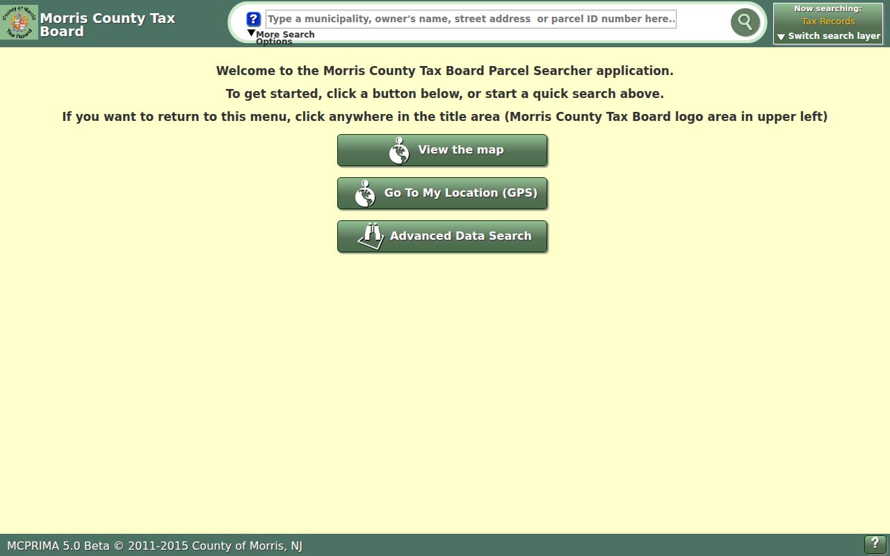
The buffer control is a practical way to inspect map context, not a shortcut to a list of people. Compare the returned parcel identifier, street spelling, and map layer with the structured Tax Board record before retaining a result.
Recorded Deeds Along Mount Olive Streets
The Clerk index is an instrument search, not a geocoder. Search party names as “Last-Name First-Name” without a comma, then narrow with date, document type, instrument number, book and page, map, parcel, district, or legal-description fields. Results can expose recorded date and time, consideration, party labels, parcel or legal-description data, and linked documents. An index entry can point to a deed, mortgage, lien, release, map, correction, or replacement, while the image itself may be restricted or absent.
For current online property work, the Morris County Clerk property-record route states coverage back to 1960. Earlier records, non-watermarked images, and certified copies belong with the Records Vault, which has books, microfilm, and digital images from the late 1700s. Mail requests need a description, return address, and check or money order. The listed fees are $1 per certified page plus $10 certification, $2 per noncertified page, and $1 postage without a stamped self-addressed envelope.
New Jersey Historic Preservation Office house-history guidance illustrates the source chain behind a Mount Olive street directory deed search.
Work backward through the grantor and grantee chain, then check wills or estates when a transfer does not look like an ordinary sale. The earliest deed located is not automatically the construction date of a surviving building.
Mount Olive Address Record Coverage
Address-keyed sources overlap, but they do not have the same meaning. A tax record supplies a tax-year property relationship, GIS supplies a current map display, and a deed supplies a recorded transaction. Municipal files may identify work proposed at a location. Voter channels carry election information with their own access rules. Keeping these categories separate is the best protection against a confident but unsupported result.
| Address record | Custodian | What it can support | Access path |
|---|---|---|---|
| Assessment and property location | Morris County Tax Board | Tax-year parcel, assessed owner, mailing address, block and lot | Online Tax Board search |
| Parcel mapping | Morris County GIS | Street, parcel, owner search, and map context | Online Parcel Searcher or Tax Map Viewer |
| Deed and recorded instruments | Morris County Clerk | Recorded party, date, instrument, book/page, legal description | publicsearch, then Records Vault, mail, or in-person access |
| Building and planning files | Mount Olive Building and Planning | Location, work type, plans, alteration dates, or applicant role | Department route or a defined OPRA request |
| Voter record | NJ SVRS and Morris County Board of Elections | Registration status or permitted voter-file information | Self-check or custodian inquiry under state rules |
The local fallback is a narrow request, not a request for a complete roster. The Township Clerk accepts records requests under the New Jersey Open Public Records Act, N.J.S.A. 47:1A-1 et seq., as amended by P.L.2024 c.16. A request should identify a record type, location, and date range. The Mount Olive OPRA form documents online or in-person processing, delivery choices, and the agency’s description field.
Mount Olive Road-Name Variants
Street research in Mount Olive needs more than one spelling. Search Mount Olive and Mt. Olive, Flanders-Drakestown and Flanders Drakestown, Budd Lake and Mount Olive, plus the Hackettstown postal form when a source uses it. For older material, add Roxbury, because Mount Olive Township formed from Roxbury Township in 1871. Flanders, Waterloo, Bartley, Drakestown, Smithtown, and Mount Olive Village can also function as community or map search terms.
No official Mount Olive street-renumbering crosswalk, E-911 readdressing notice, or complete historical street-name table was located. That gap matters. A county historical-society example about a different municipality is not proof of a Mount Olive number change. Preserve the source spelling, search the legal-description field when needed, and use prior block and lot, maps, newspapers, or a custodian request before asserting that two numbers are the same place.
- Parcel
- A tract identified in the tax and map system, often by district, block, lot, and sometimes a qual code.
- Situs address
- The location of the parcel. It can differ from the owner’s mailing address.
- Plat
- A recorded map that depicts lots, roads, or other parcel layout information.
- Criss-cross directory
- A dated reverse directory arranged by address, used to compare a past listing with a street.
Mount Olive Building Permit Leads
Building and Planning records can date a change at an address. The local materials describe permits and forms for construction, zoning, site work, signs, appeals, and related property activity. A file may contain a location, owner, work description, plans, survey, construction material, floor-plan details, or alteration date. It may also name an applicant, contractor, or agent. That makes it a property-history lead rather than evidence about present occupants.
Start with the Mount Olive Building Department or Planning and Zoning, then use a defined OPRA request if a posted search does not expose the file. The research did not locate a complete publicly indexed permit series, so confirm retention, available fields, and redactions with the custodian.
Note: A permit can date a project or describe an applicant role, but it cannot by itself establish who lived at the property.
Mount Olive Voter Address Checks
Voter information has a separate purpose and access path from parcel research. The public-facing SVRS route is a registration self-check. State guidance says matching can depend on county spelling, middle initials, hyphens, date of birth, city or county, and status. The live registration-check form was blocked during research inspection, so a particular screen layout should not be assumed. Morris County Board of Elections is the correct follow-up custodian for voter-file copies, registration questions, and election records.
Use a voter result as a registration fact with its own date, not as a household list. A status can change, and an inactive entry is a registration status rather than proof that a person vanished. Protected-address and voter-nondisclosure rules can apply. Keep the voter channel separate from tax ownership, deed parties, and historical listings when recording any street-by-street result.
Earlier Mount Olive Street Sources
For earlier address context, the Records Vault is not a dead end. Its late-1700s-forward material extends beyond the Clerk’s stated 1960 online property coverage. The Rutgers F.I.R.O. map record is a public-access 1950 map for Mount Olive Township, Budd Lake, Flanders, and Bartley. It can show built form, road patterns, structures, and labels at that time, not a complete list of households.
Mount Olive Public Library and Morris County Library can help with local vocabulary, newspapers, maps, directories, microfilm, and archival referrals. County historical surveys and maps can identify historic districts or sites, but an old-looking structure should not be treated as listed without checking the underlying survey or register. Save the edition, map date, page, instrument, or staff-assisted collection name with each street finding.
Limits of a Mount Olive Street Directory
No official Mount Olive database was located that establishes every person at every address. A title holder, owner mailing address, voter registration, permit applicant, court party, and historical directory entry describe different relationships to a place and time. Postal labels add another layer: a Hackettstown postal label can appear on a Mount Olive route, while the Tax Board and GIS supply the jurisdiction and parcel evidence.
When sources disagree, retain both record labels and dates. A conflict between an older directory and a current tax record may simply reflect time, while a conflict between a situs address and owner mailing address reflects different fields. A careful Mount Olive street directory result says what the record actually supports.